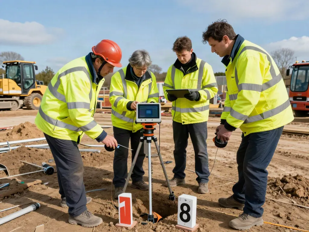
Understanding Utility Surveys in Surrey
Utility surveys are critical components of planning and executing construction projects. In Surrey, the need for accurate underground utility mapping is paramount, as it helps builders avoid costly mistakes and enhances safety by identifying potential hazards. This article will delve deep into what utility surveys entail, the benefits they offer, common misconceptions, and best practices for conducting them effectively. For those in search of local expertise, Utility Surveyors Surrey provide essential services tailored to the unique needs of this region.
What is a Utility Survey?
A utility survey is a comprehensive examination of underground utilities and infrastructure, which includes but is not limited to water, gas, electricity, telecommunications, and sewage systems. The primary objective of these surveys is to accurately map the location and depth of existing underground utilities before any excavation or construction begins. This is typically achieved using advanced technologies such as Ground Penetrating Radar (GPR), electromagnetic induction, and utility tracing techniques.
Benefits of Utility Surveys for Projects
- Risk Mitigation: By identifying the exact locations of underground utilities, utility surveys significantly reduce the risk of accidental damage during construction, which can lead to project delays, added costs, and safety hazards.
- Cost-Efficiency: Knowing where utilities are positioned allows project managers to plan more effectively, minimising the potential for expensive on-site alterations and disruptions.
- Regulatory Compliance: Many construction regulations require a thorough utility survey before any ground-breaking activities. Compliance with these regulations helps avoid legal repercussions and ensures a smooth project flow.
Common Misconceptions about Utility Surveys
Despite their importance, utility surveys are often misunderstood. One common misconception is that utility surveys are unnecessary for smaller projects. In reality, even minor construction work can lead to significant problems if utility lines are not properly mapped. Another misconception is that utility surveys are only needed once; however, regular updates are necessary, especially in rapidly developing areas where new utilities may have been installed.
Common Pitfalls in Utility Surveying
Ignoring Ground Conditions: Impacts on Accuracy
One of the most significant pitfalls in utility surveying is overlooking the ground conditions. Soil composition, moisture levels, and other geological factors can affect the accuracy of surveys. For instance, GPR technology can yield varying results based on soil type; failure to account for these variables can lead to inaccurate mapping.
Underestimating the Importance of Technology
The utility surveying industry has evolved significantly with technological advancements. Utilizing outdated equipment or techniques can lead to subpar results. Modern methods, such as 3D scanning and advanced GIS (Geographic Information Systems), provide a more comprehensive understanding of underground utilities, enhancing project planning and execution.
Not Involving Local Experts - Why It Matters
Every region has its unique set of challenges in utility surveying, particularly in areas like Surrey, where historical infrastructure might complicate matters. Engaging local experts ensures that the specific nuances and regulations of the area are considered, leading to more reliable and accurate surveys.
Best Practices for Conducting Utility Surveys
Essential Tools and Equipment for Surveyors
Successful utility surveying hinges on the use of appropriate tools and equipment. Essential tools include:
- Ground Penetrating Radar (GPR): Ideal for locating underground pipes and cables without excavation.
- Electromagnetic Locators: Useful for tracing conductive utilities like water and electrical lines.
- Utility Mapping Software: To record and visualise data accurately, facilitating easier collaboration and data sharing.
Implementing PAS 128 Standards in Surveys
The PAS 128 standard provides a framework for achieving effective utility mapping. Adhering to these standards ensures the reliability and accuracy of survey results. This includes categorising utilities based on the level of accuracy required for the specific project, which is crucial for effective planning and decision-making.
Effective Communication with Stakeholders
Communication is vital throughout the surveying process. Engaging stakeholders—including contractors, engineers, and local authorities—ensures that everyone is on the same page regarding utility locations, potential risks, and project timelines. Clear communication can prevent misunderstandings and promote collaboration, ultimately leading to project success.
Real-World Examples of Utility Survey Failures
Case Study: Major Project Delays Due to Poor Surveying
A significant case involved a major infrastructure project in Surrey where inaccurate utility mapping led to the severing of an underground gas line. The incident resulted in widespread disruption, expensive repairs, and extensive project delays. Upon investigation, it was determined that the initial surveys had not been conducted according to best practices, highlighting the importance of thorough and accurate utility surveys.
Lessons from Surveys Gone Wrong
This incident serves as a reminder that cutting corners in utility surveying can have severe consequences. Lessons learned include the need to regularly update utility records, utilise advanced technology, and involve local experts in planning phases.
How Accurate Surveys Can Save Costs
Accurate utility surveys can lead to significant cost savings over the life of a project. By investing in proper surveys upfront, companies can avoid unexpected disruptions, reduce construction delays, and enhance safety. The investment in utility surveying pays dividends in the long run.
The Future of Utility Surveying in 2026 and Beyond
Innovative Technologies Shaping the Industry
The utility surveying field is evolving with the introduction of innovative technologies such as AI-driven mapping and advanced data analytics. These advancements promise greater accuracy in identifying utility locations and predicting potential problems before they occur.
Predictions for Utility Surveying Practices
As we move towards 2026, it is expected that utility surveying will place an even greater emphasis on sustainability and environmental considerations. The integration of eco-friendly practices in construction will necessitate more precise utility mapping and planning, driving the demand for quality utility surveyors.
Preparing for Changes in Regulations and Standards
With ongoing reforms in construction regulations and standards, utility surveyors must remain abreast of new developments to remain compliant. Staying informed will ensure that surveying practices align with evolving industry expectations and regulatory requirements.
What is a utility survey?
A utility survey is an assessment performed to locate and delineate underground utilities such as cables, pipes, and other infrastructure.
How much is a surveyor's fee?
The cost of hiring a surveyor can vary widely based on the size and complexity of the project, as well as the specific services required. On average, fees can range from £300 to £1,500 or more.
What are two main types of surveyors?
The two main types of surveyors are land surveyors, who assess land boundaries and features, and utility surveyors, who focus specifically on underground assets.
Will surveying be replaced by AI?
While AI is becoming an integral part of the surveying process by improving efficiency and accuracy, it is unlikely to completely replace human surveyors. Instead, it will augment their capabilities, allowing for more informed decision-making.
What are the benefits of PAS 128 compliance?
Compliance with PAS 128 standards ensures high-quality and reliable utility surveys, reducing the risk of errors, enhancing project planning, and ultimately saving time and money.